


| Technical Name | Mobile Magnetic Survey System | ||
|---|---|---|---|
| Project Operator | National Central University | ||
| Project Host | 陳建志 | ||
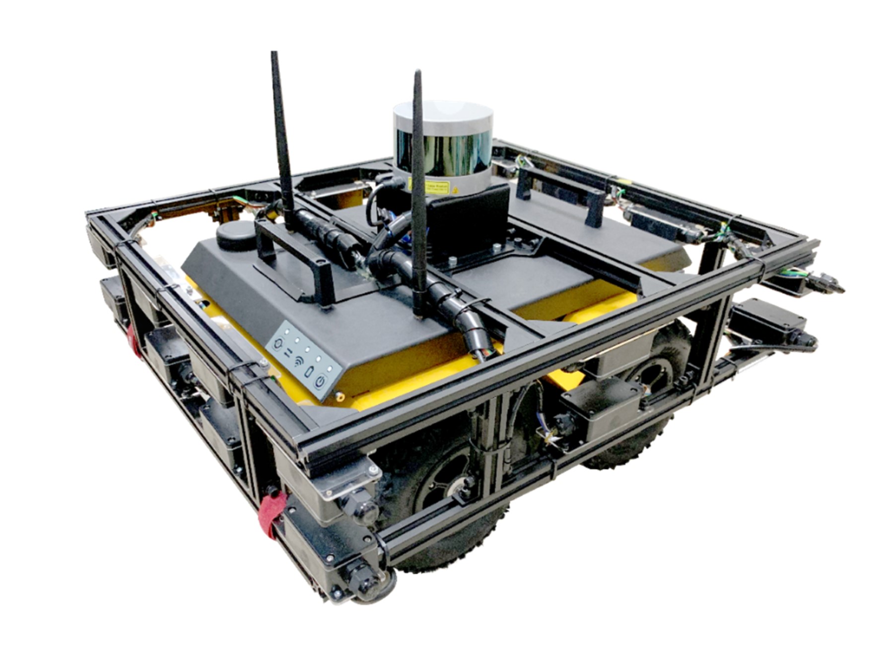
| Summary | Mobile Magnetic Survey System is composed of 20 precisesensitive magnetic detector arrays, which are used for measuring the 3D magnetic fields. With the LiDAR positioning systemattitude rotation, the magnetic vector field can analyze the magnetic field intensity at different positions. In addition, the visualized map can help users to evaluate the metal body locationdepth. |
||
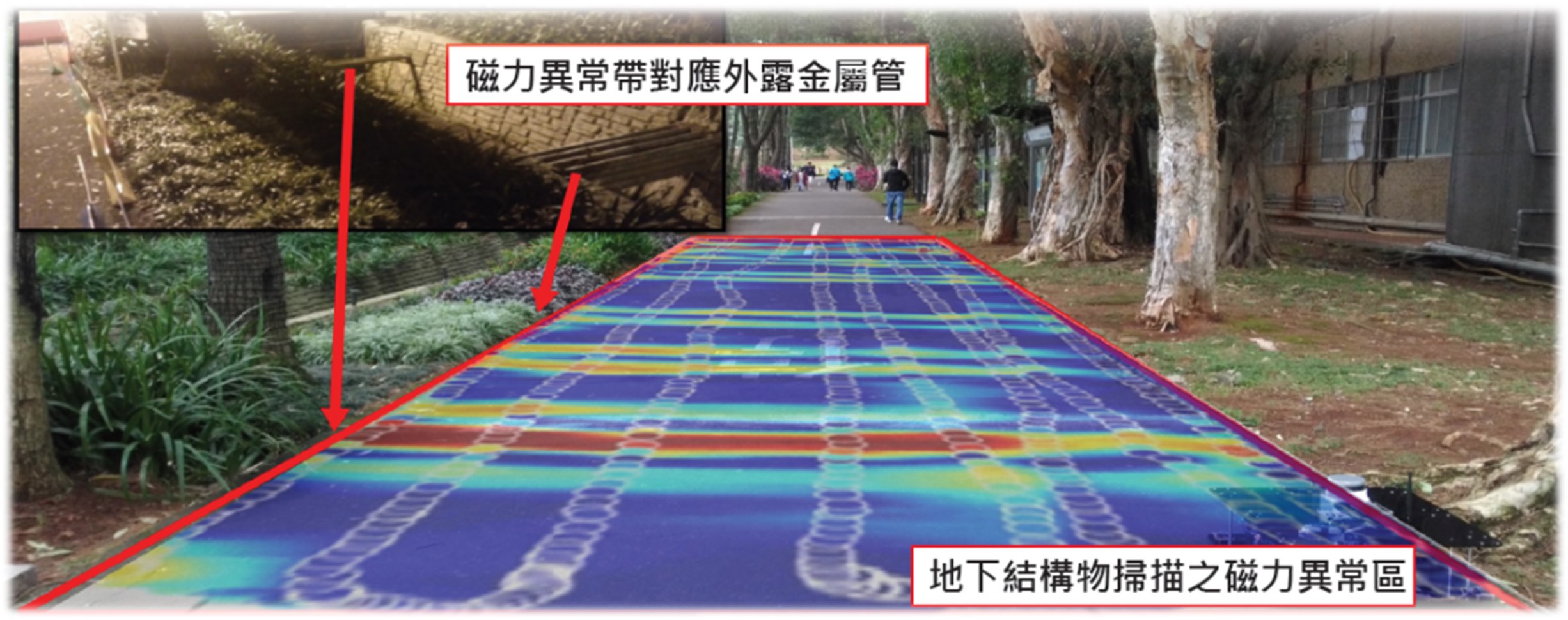
| Scientific Breakthrough | Mobile Magnetic Survey System breaks through the limitations of single point measurement, uses multiple magnetic detectors to record 3D magnetic fields. Therefore, it can quickly record the magnetic signals to reduce the effect from the magnetic diurnal variations. Besides, the interference of internal instrumentthe deviation caused by the attitude are also corrected to improve the detection accuracy. |
||
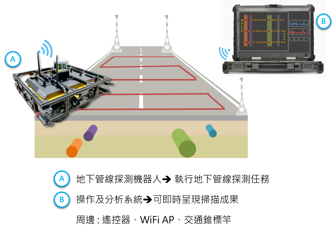
| Industrial Applicability | Mobile Magnetic Survey System is mainly applied to the detection of subsurface metal pipelines. Before the road excavation works, the system scan the distribution of metal pipelines, to prevent the accidental interruption of living systems such as gas pipelinespower lines. Besides, the system can also be used for the subsurface metal structure scanning, anti-terrorism detection,buried disaster detectionpose-disaster assessment. |
||
| Keyword | Magnetic Survey Pipeline Detection Iron Detection Nondestructive Testing Near-Subsurface Exploration Geophysical Exploration Civil Engineering Exploration Unmanned Vehicle Pipeline Damage Prevention Road Excavation Accident Prevention | ||
- cindy08816@gmail.com
other people also saw