
| Technical Name | Multi-View Spatiotemporal Graph Fusion AI for Sensor-Less Regional Risk Early Warning and Decision Support | ||
|---|---|---|---|
| Project Operator | National Cheng Kung University | ||
| Project Host | 解巽評 | ||
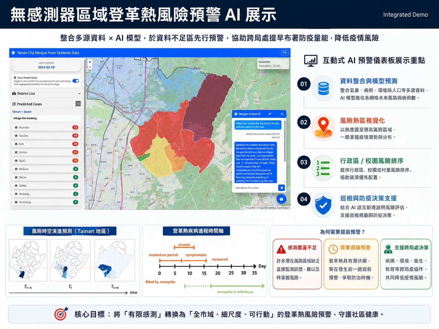
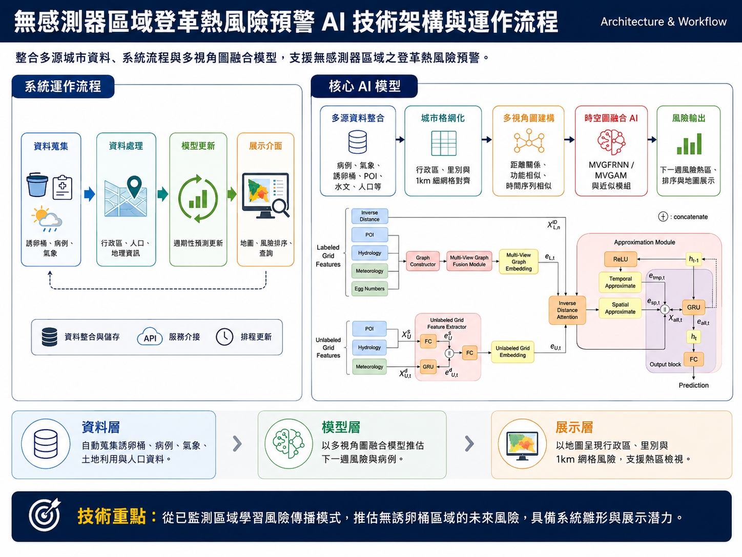
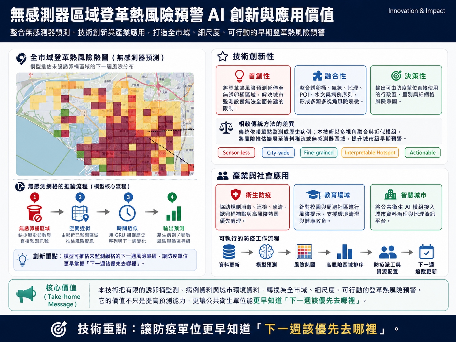
| Summary | An AI early warning technology that predicts dengue risk in sensor-less urban grids by fusing ovitrap, meteorological, geographic, POI, and hydrological data through multi-view spatiotemporal graph learning. It produces citywide hotspot maps, school-neighborhood risk rankings, and resource-allocation support for public health agencies. Validated in Tainan school dengue prevention, it supports public-health early warning, cross-agency coordination, and smart-city governance. |
||
| Scientific Breakthrough | The technology extends dengue prediction from sensor locations to sensor-less urban grids. It combines multi-view spatiotemporal graph fusion, graph attention, self-attention, and inverse-distance attention to capture spatial, functional, and temporal dependencies, improving fine-grained citywide early warning, high-risk hotspot detection, and transferability to other sensor-sparse urban problems. Validated on real Tainan data, it also demonstrates deployability in school dengue prevention. |
||
| Industrial Applicability | The technology helps health, education, and smart-city agencies generate AI risk hotspot maps, inspection lists, and resource-allocation suggestions for vector control, disinfection, school protection, and dispatch management. It reduces blind spots in sensor-sparse areas and can be extended to other urban risk-management services. It can be commercialized as a SaaS dashboard or integrated with GIS, IoT, dispatch, and school-safety systems for scalable deployment. |
||
- Contact
- Hsun-Ping Hsieh
- hphsieh@mail.ncku.edu.tw
other people also saw