


| Technical Name | All weather UAVs/sensors for atmosphere and air quality monitoring | ||
|---|---|---|---|
| Project Operator | National Central University | ||
| Project Host | 王聖翔 | ||
| Summary | This technology aims to develop a set of UAV and monitoring technology suitable for the atmosphere. By breaking through the limitations of weather conditions, to explore the vertical development structure of the atmosphere and the changes of air pollutants, and help parameterize the unknown physical and chemical mechanisms of atmosphere to improve weather and air pollution model forecasting. |
||
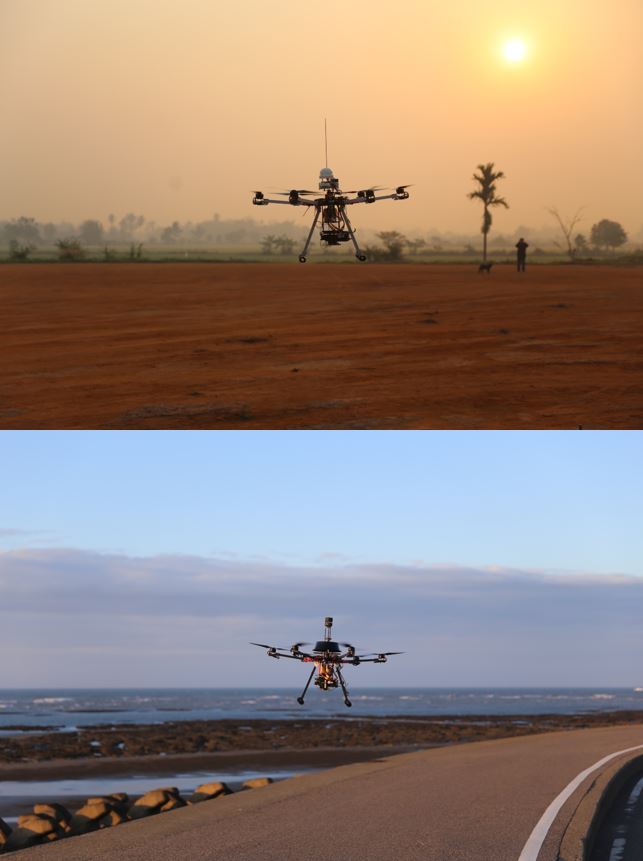
| Scientific Breakthrough | This technology has superior unmanned aerial vehicle performance, all-weather observation, system integration, and cost advantages, breaks the bottleneck of atmospheric vertical observation, and has obtained a cooperation invitation from the NASA team. In the past, 24 hours of continuous profile observations were completed to analyze the unprecedented continuous vertical structure of the atmosphere, capture the vertical mixing characteristics of pollutants, and suggest that the deterioration of ground air pollution may come from the air above your head. Observation in the cloud and rain, let us understand that the white cloud may not be the white you imagined. |
||
| Industrial Applicability | The drone developed by our team is equipped with a series of atmospheric and air pollution monitoring instruments or sensors, which will provide industrial applications such as environmental monitoring, smart agriculture, transportation, defense, and military. For example, assisting environmental protection inspectors to conduct the inspection of air pollution, helping firefighters collect real-time fire information. In addition to, for the current pesticide spraying technology or future goods transportation, this technology provides real-time environmental monitoring information, which is conducive to flight mission scheduling and risk control. |
||
| Keyword | Unmanned Aerial Vehicle Rotor craft Air pollution PM2.5 Atmosphere Monitoring Severe Weather Rainmaking Automatic Scheduling Long-range Radio Transmission Real-time Image | ||
- b95605041@g.ncu.edu.tw
other people also saw