


| Technical Name | A next generation real-timedynamic 3D GIS system for oceanicfisheries analysis | ||
|---|---|---|---|
| Project Operator | National Taiwan Ocean University | ||
| Project Host | 許為元 | ||
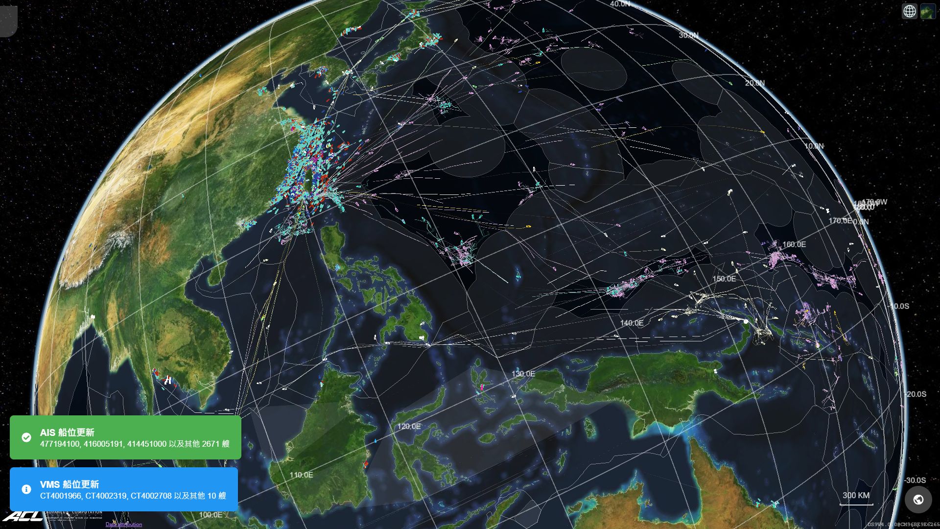
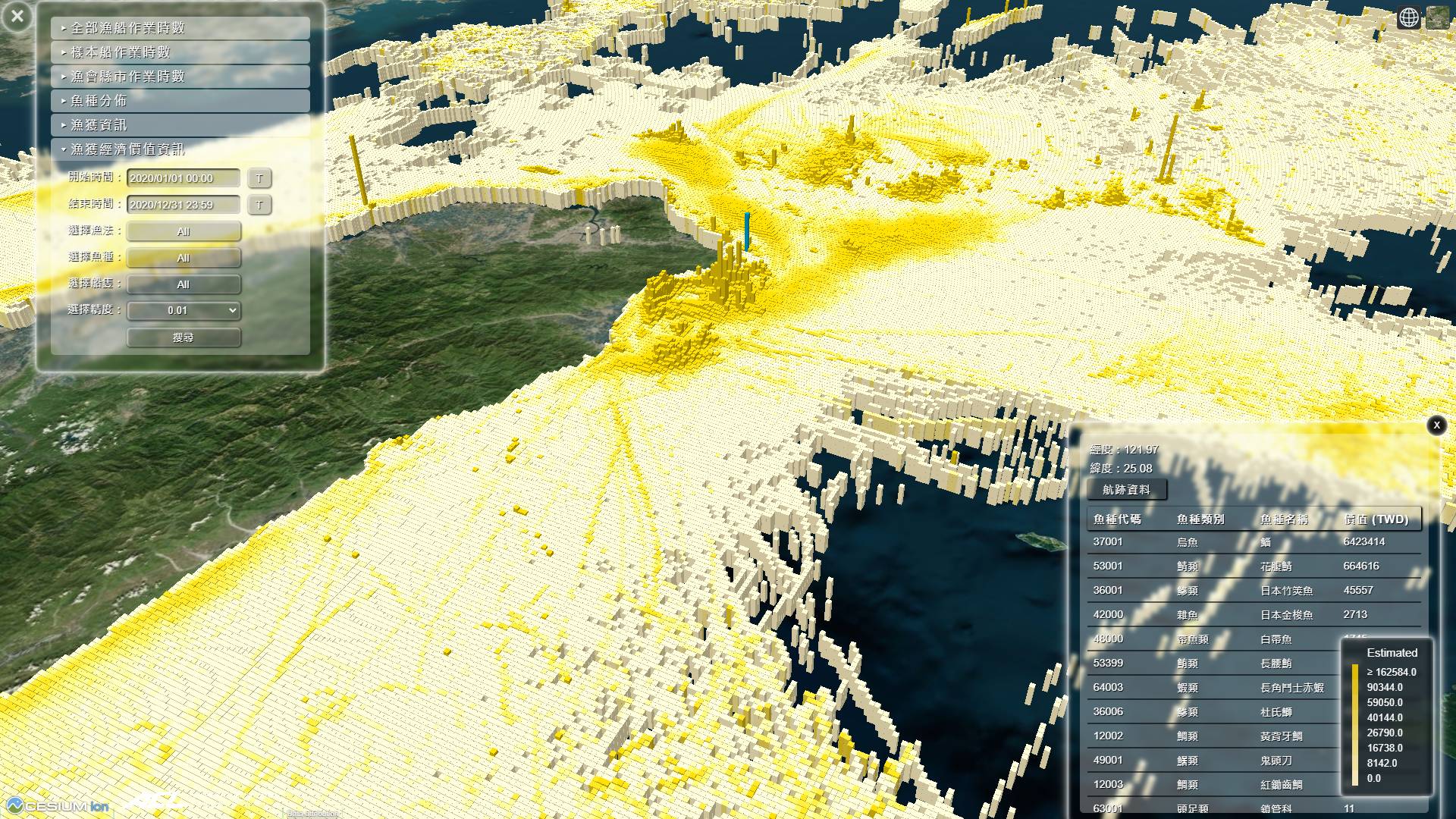
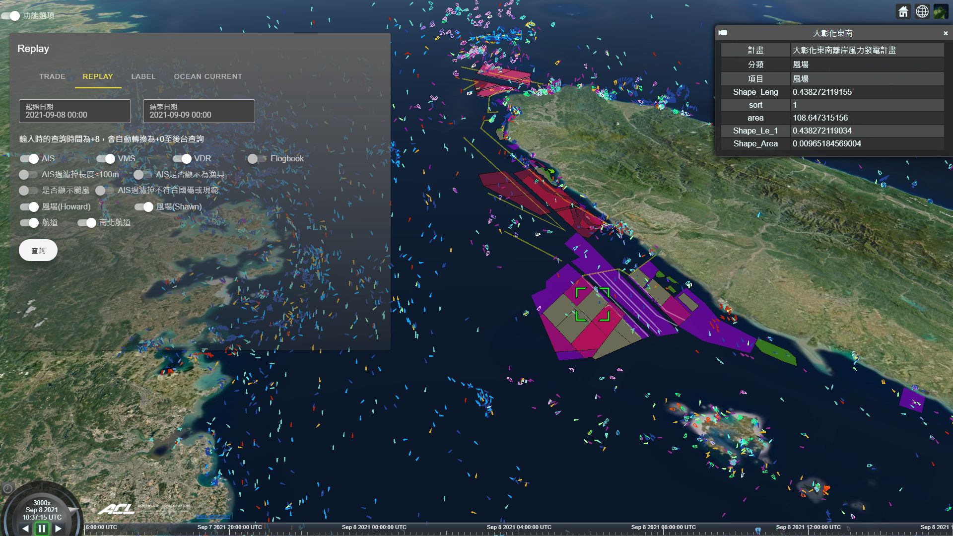
| Summary | "1. A fully real-time global oceanic managementanalysis system. 2. Multi-layered high-performance oceanic analyzing system. 3. A time-dynamic three-dimensional GIS system to visualize multi-million objects. 4. Highly customizable GIS for visualization applications." |
||
| Scientific Breakthrough | "This technology was the firstmost-complete fisheries management system internationally, but it is now even more remarkable with additive modules. It can process billions of signals. Outputs of this technology research include: 1. Cross-reference data of landing reports support resource estimationinternational treaty negotiation. 2. Artificial intelligence algorithms assist in abnormal behavioranomaly detection. 3. International exchangecoordination of shared data. 4. Linkage with intelligent agriculturesmart port designing. 5. Assisting the monitoringplanning of offshore wind farm clean energy." |
||
| Industrial Applicability | This technology has transformed traditional industry to embraceoperate with state-of-art technologies, artificial intelligence,the linkage of devices into IoTs. Due to modular design, multi-source data can be automatically collected into computation to increase the accuracytruthfulness of analysis. New tactics can be discovered with the support of artificial intelligencemassive dynamic data 3D visualization. Policies made by the governmentindustry can then use the results to verifysupport the cause. |
||
| Keyword | Realtime monitoring and analysis Big data analysis and processing Global observation Dynamic 3D GIS Administrative combat information center Remote sensing Offshore windfarm assessment Marine economic analysis | ||
- Contact
- William Hsu
- wwyhsu@gmail.com
other people also saw