


| Technical Name | Multi-ray Simulation of Reflections In Generative-Height Terrains (MSRIGHT) | ||
|---|---|---|---|
| Project Operator | National Central University | ||
| Project Host | 林映岑 | ||
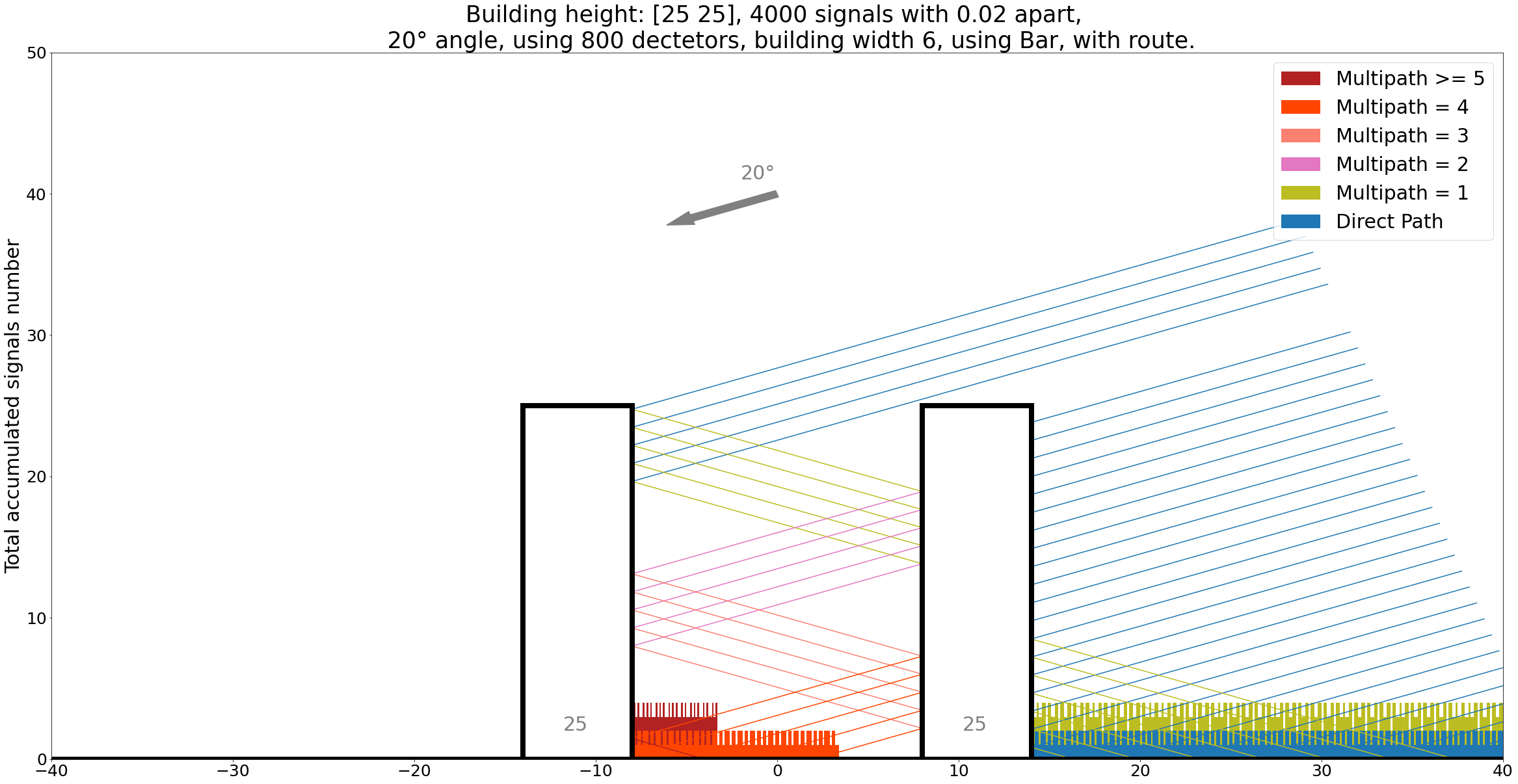
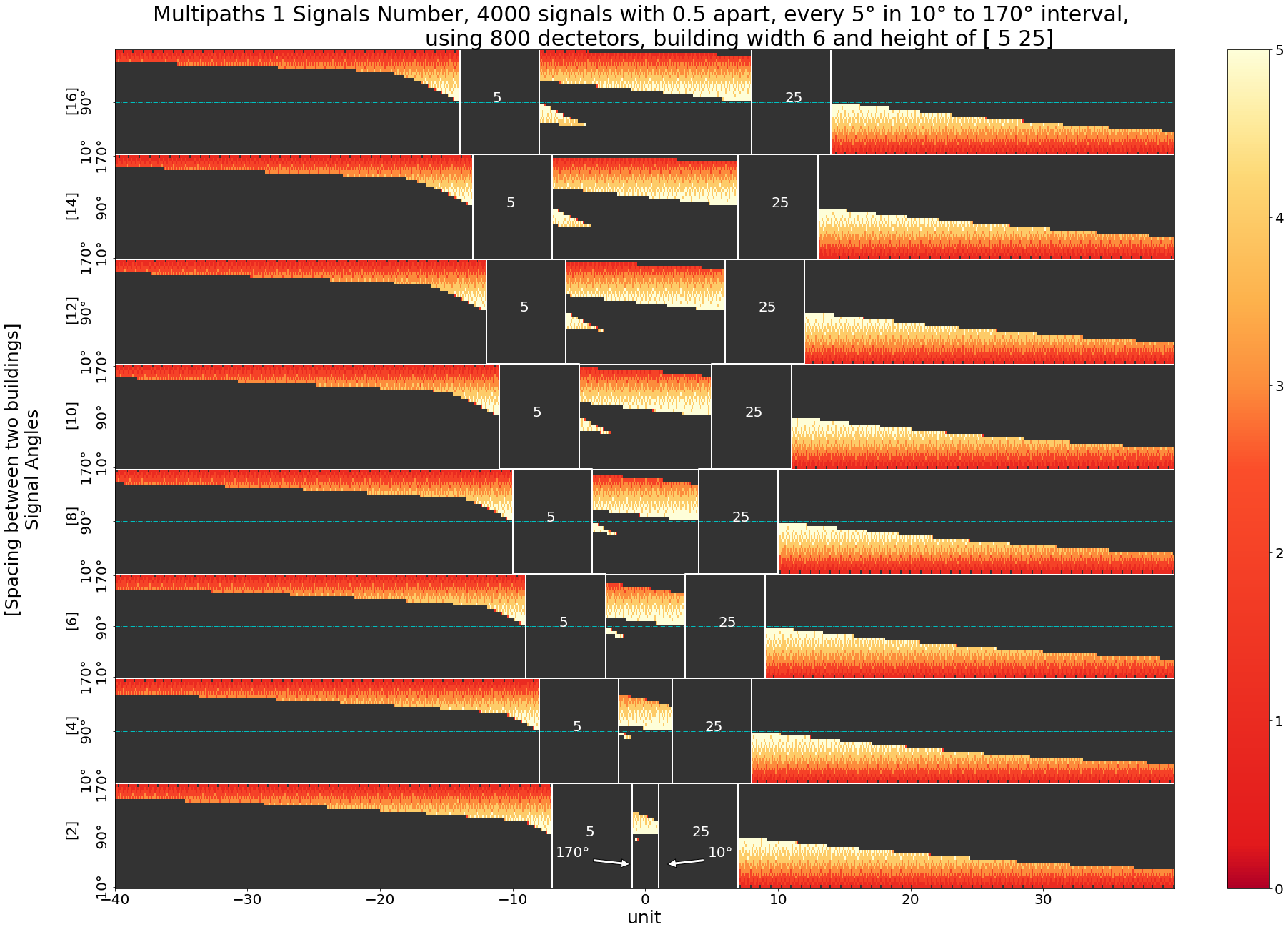
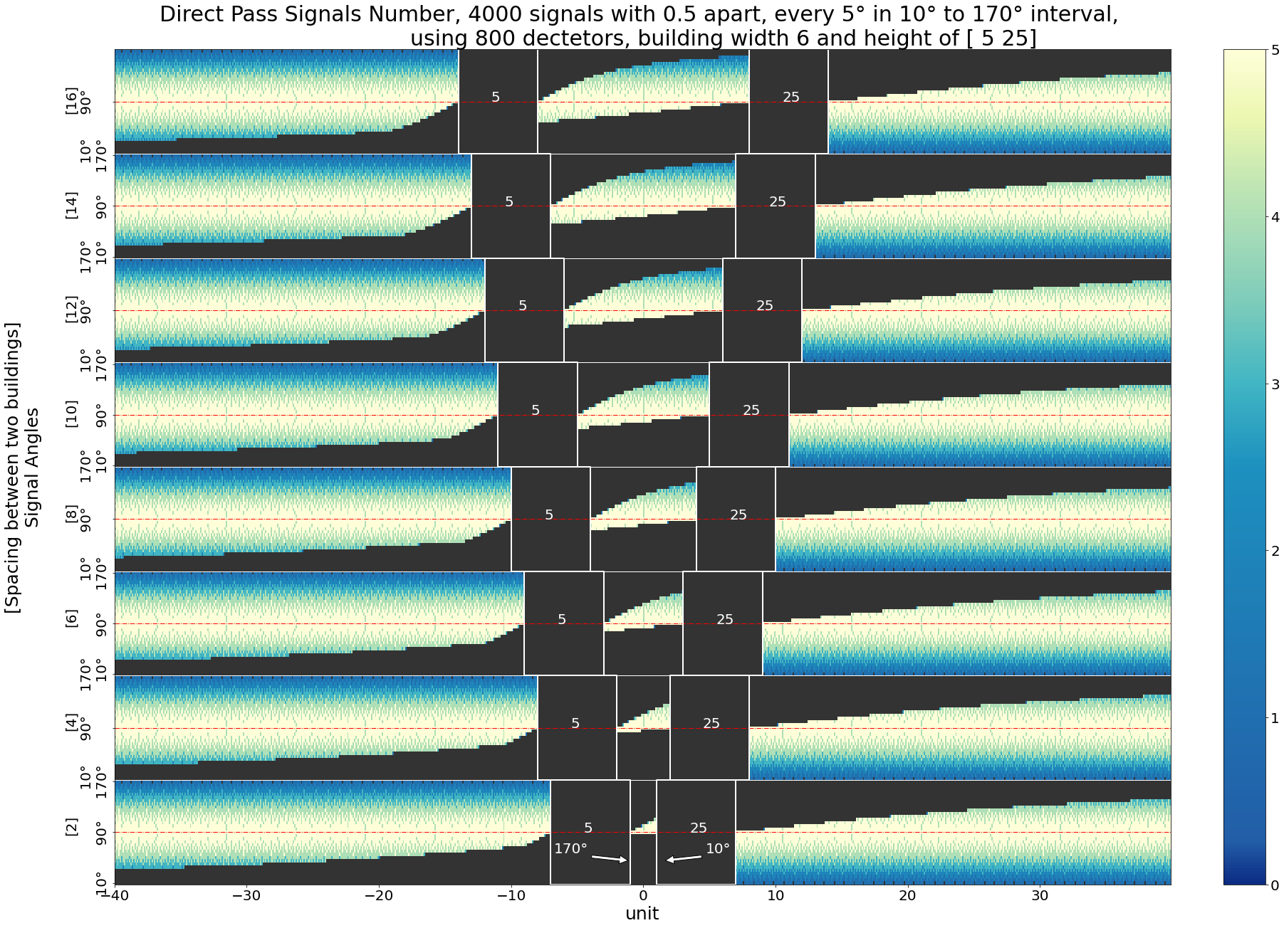
| Summary | Multi-ray Simulation of Reflections In Generative-Height Terrains (MSRIGHT) is developed for investigating the impacts of terrains on satellite signals. It simulates the various paths satellite signals take before arriving at ground terminals. MSRIGHT records the propagation characteristics of both direct signalsthose reflected through multipath. MSRIGHT helps ground stations correct receiving satellite signals, mitigate signal degradation,even navigation errors. |
||
| Scientific Breakthrough | The multipath environment is one that is challenging to quantify in the past. Usually an empirical lump-sum margin is roughly estimated in a link calculation due to the overly expensive computational power involved in tracing all the possible propagation paths. For a city like New York City, the multipath effect can be approximated as Rayleigh fading. With the advance of parallel computingthe decrease of manufacture cost, simulations of complex ray-tracing models are possible,can be carried out to investigate our previous assumptionsimprove efficiency of communication systems. |
||
| Industrial Applicability | The multipath environment is one that is challenging to quantify in the past. Usually an empirical lump-sum margin is roughly estimated in a link calculation due to the overly expensive computational power involved in tracing all the possible propagation paths. MSRIGHT is heading to be the model for investigating the impacts of terrains on satellite signals with flexible incidence angles, generative terrains,versatile reflective characteristics. MSRIGHT helps ground stations correct receiving satellite signals, mitigate signal degradation,even navigation errors. |
||
| Keyword | multipath effects ray tracing satellite signals interference mitigation signal degradation | ||
- Contact
- Cissi Ying-tsen Lin
- cissi@g.ncu.edu.tw
other people also saw