


| Technical Name | ANGEL – AI Drone-Assisted Disaster Relief Systems | ||
|---|---|---|---|
| Project Operator | National Chiao Tung University | ||
| Project Host | 王蒞君 | ||
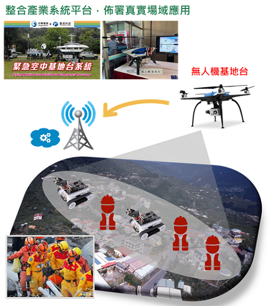
| Summary | When a disaster occurs, the communication system may fail, resulting in difficulty in rescue. If you want to send the UAV as a low-altitude mobile flying angel base station to help the rescue tasks, you need to deploy it correctly. If the deployment is not good, a lot of search and rescue time will be wasted, and the communication quality is even worse, thereby increasing the risk of search and rescue personnel who become victims. Therefore, we proposed a set of AI drone-assisted disaster relief system that integrates the key technologies of "AI software" and "AI hardware". AI software integrates image and radio data fusion technology and 3D+R data reconstruction technology. Through the integration of lightweight AI-hardware Edge-AI platform and AI drone IoT communication platform, the radio in the disaster relief area is quickly reconstructed Maps to assist in the deployment of angel base stations (UAVs) and provide a stable communication network to assist disaster relief tasks. |
||
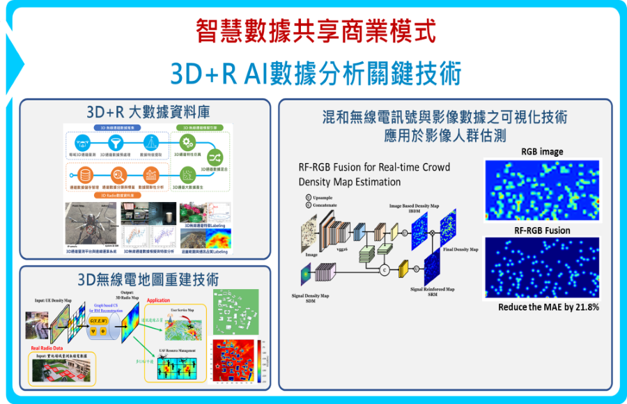
| Scientific Breakthrough | The spatial correlation-based compressive sensing (SC-CS) radio map reconstruction technology developed by this team can solve the reconstruction error problem caused by uneven distribution of ground UEs (uneven distribution of collected samples), so that the air angel base station can According to the current distribution characteristics of different people (samples), quickly and adaptively reconstruct the radio map of the field. Compared with traditional radio map construction technology, SC-CS reconstruction accuracy is 36% higher. |
||
| Industrial Applicability | For the AI drone disaster prevention and relief system, the team developed a long-stay air drone and AI-assisted drone precision deployment system, providing rescue angel base stations in disaster areas, accurately identifying the rescuers, quickly establishing the best base station location, and providing rescuers High-quality communication with search and rescue personnel, master the golden search and rescue time and reduce the risk of search and rescue personnel. |
||
| Keyword | Radio Map Compressive Sensing Flying Base Station Disaster Relief System | ||
- cclai1109@nctu.edu.tw
other people also saw