


| Technical Name | Towards Automatic Hyperspectral Imaging via the Combination of Sample Navigation MappingLaser Scanning Spectral Microscopy | ||
|---|---|---|---|
| Project Operator | National Taiwan University | ||
| Project Host | 張玉明 | ||
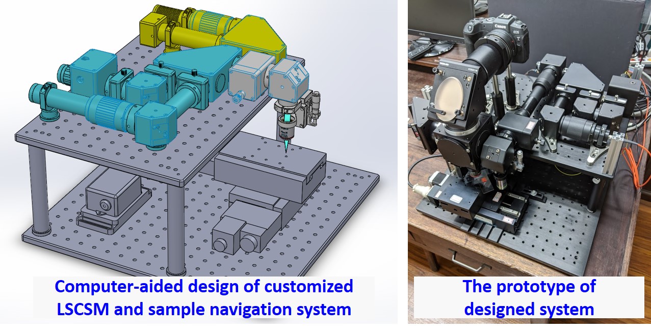
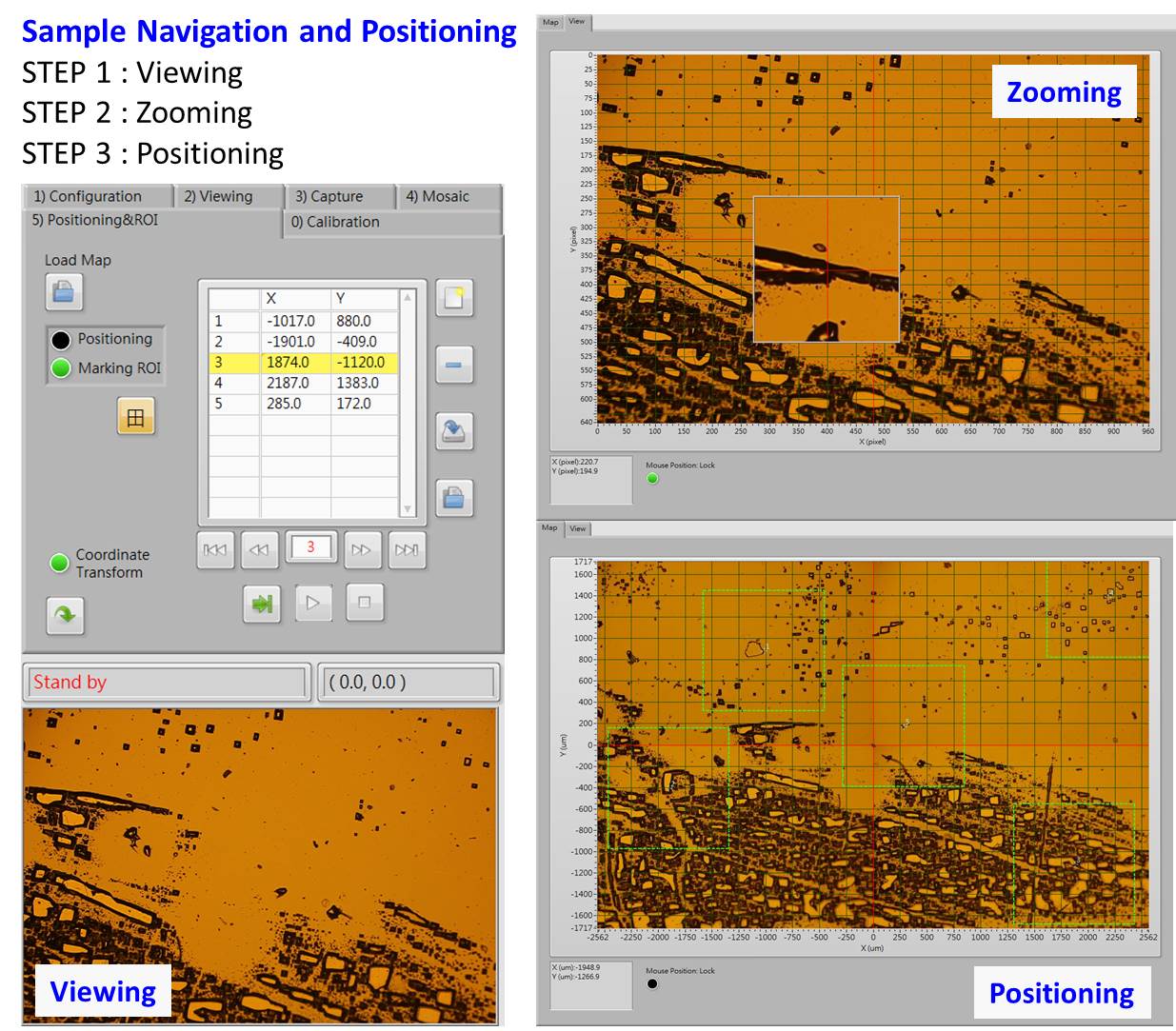
| Summary | Photonic_Workshop@CCMS.NTU has successfully developed a motorized micro-mapping system to explore and navigate samples. This system is able to acquire high resolution images to produce a sample map automatically. This map is also synchronized with the coordinates of motorized stages. This achievement allows users to explore and position their hotspots from the map, and precisely deploy the hotspot to the central field of view by motorized stages. In addition, this mapping system can combine with a laser scanning confocal spectral microscope (LSCSM) to acquire sample spectral mapping. Our result has shown the capability to improve the efficiency of hotspot positioning and data acquisition process. |
||
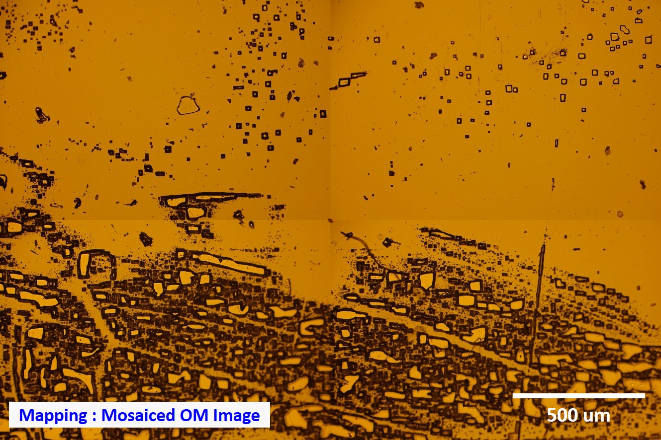
| Scientific Breakthrough | This micro-mapping system aims at producing a sample map for navigation instead of directly exploring from an objective. This sample map can provide a complete picture and prevent the drawback of narrow field of view from an objective. Our system belongs to a multidisciplinary achievement including microscopy, customized mechatronics system, and geospatial information system. This system can capture sample images from different locations to mosaic a larger scene. The spatial resolution of scene can reach 0.4 um currently. Furthermore, we also integrate this scene with coordinates and attributes as a map for positioning and sample navigation. This system can also combine with the laser scanning confocal spectral microscopy to acquire spectral mapping at the precise location. |
||
| Industrial Applicability | The measuring performance is a crucial index in industrial circles including semiconductor, electronic component, two-dimensional material, biomaterial, etc. Our micro-mapping system used a low-magnification objective to produce the whole scene for sample navigation. A high-magnification was then selected to acquire sample spectra, i.e. photoluminescence or Raman, at each hotspot. This technique has the capability to automatically measure multiple areas on a surface instead of sampling measurement. |
||
| Keyword | Automated Customized Micro-mapping Navigation Laser Scanning Confocal Spectrum Positioning Geographic Information System Motorized Stage | ||
- lo.chaoyuan@gmail.com
other people also saw