


| Technical Name | Ease-x (Earth environmental data & value-added services) | ||
|---|---|---|---|
| Project Operator | National Central University | ||
| Project Host | 倪春發 | ||
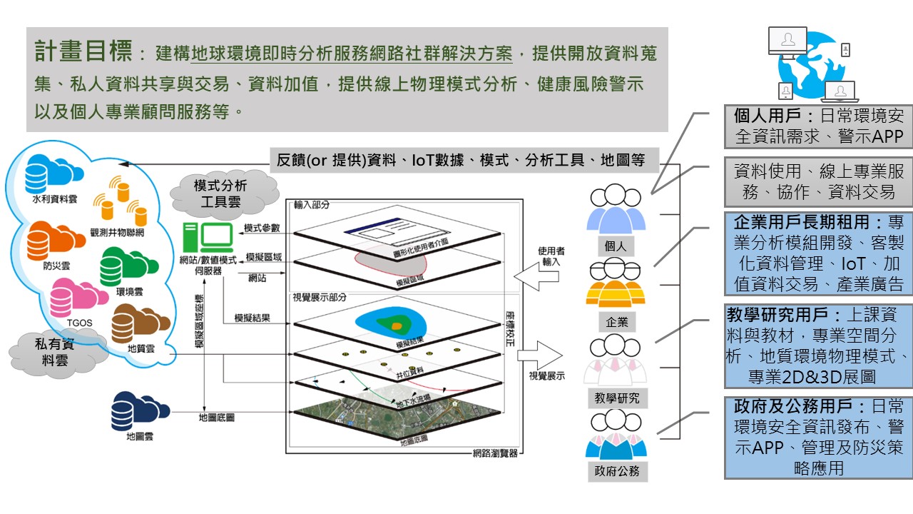
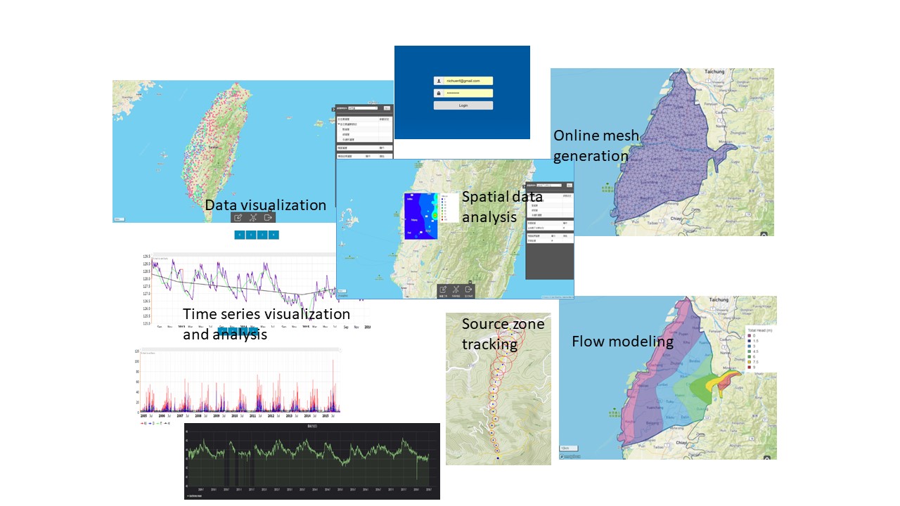
| Summary | Geographical Information System (GIS) is developed based on the map information that provides tools for multidisciplinary implementations. The proposed modulized platform is the first that integrates the in-house GIS platform and many numerical models for visualization of Earth environmental data and value-added services (Ease-x), where the “-x” can be different implementations of earth environmental issues such as soil, water, air, or ocean. The Ease-x platform focuses on the field of groundwater relevant implementations. The Open Street Map is available on the platform, and the platform allows for online visualization of open geological data and groundwater modeling and data analysis. Users can use different web browsers to access the platform. The feature of the user management system was designed to process teamwork for the same groundwater modeling project. Such a feature significantly improves the conventional workflows and tasks involved in a groundwater modeling project. |
||
| Scientific Breakthrough | The conventional groundwater-related Web GIS platforms used scripts to transform the inputs and outputs between visualization platforms and numerical models. The users have little interactions with the platforms. The simulations of the groundwater models are basically off-line. The main feature of the proposed Ease-x platform is the realtime interactions, modeling, and 3D visualization. The user management system in the platform allows the teamwork for the same groundwater modeling project (similar to the concept of online gaming systems). Such a feature enables the collaboration of data preparation and model development. The logical procedures of the groundwater modeling project have been improved considerably and can be implemented for other geospatial applications. |
||
| Industrial Applicability | The developed web-GIS platform Ease-x enables realtime interactions, realtime modeling, and realtime 3D visualization. With big data collected from users, the platform provides data and value-added services for different industrial implementations. The unique feature enables future data trade and user-to-user professional services. |
||
| Keyword | Web-GIS Numerical models Groundwater Contaminant transport Mesh generation AIoT Open Street Map Realtime observations Spatial interpolation Value-added services | ||
- wiki70170@gmail.com
other people also saw