


| Technical Name | Application of Internet of Things(IoT) in Flood Monitoring | ||
|---|---|---|---|
| Project Operator | National Science and Technology Center for Disaster Reduction | ||
| Project Host | 蘇文瑞 | ||
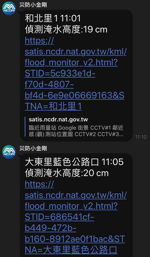
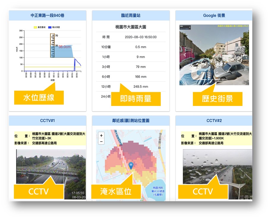
| Summary | Combining automatic real-time flood sensing technology from Civil IoT with real-time precipitation data from CWB to reduce the incidence of false alert. By merging technology with Google Street View, terrain data and real-time observation image from MOI, users can easily get information about flooded area through Disaster Response Decision Support System (DRDSS) |
||
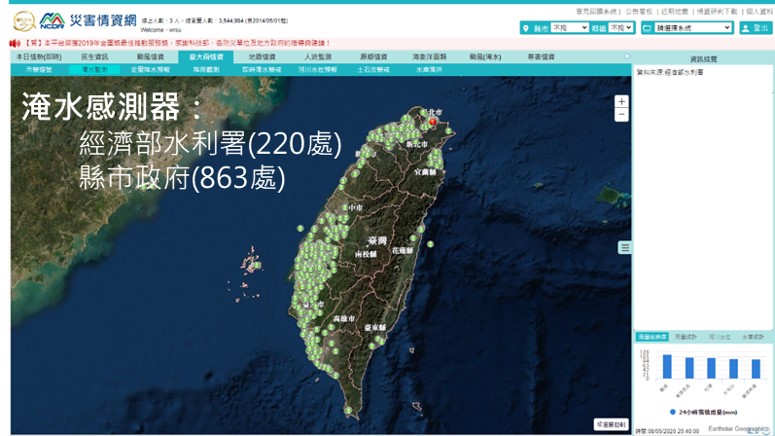
| Scientific Breakthrough | The Intellectual real-time Push Notification technology on disaster prevention, combining flooding sensor and precipitation data from CWB with CCTV and Google Street View, can be used to simulate disaster projection through traffic-network analysis. Importing 3D visualization techniques, along with big data integrated by NCDR, be able to improve precision of meta image and data simulation, aiding citizens and local government in decision-making and resources allocation stage, also can be used by local government in programming stage of disaster prevention. |
||
| Industrial Applicability | The technology can combine flood, precipitation and real-time image data by using data networking. For flood monitoring, it can be practically used in disaster prevention, providing commanders the precision of the events. This technique had achieved early warning during Typhoon Hagupit in 2020. |
||
| Matching Needs | NA |
||
| Keyword | DRDSS NCDR Disaster Reduction Flood monitoring IoT | ||
- chyang@ncdr.nat.gov.tw
other people also saw