


| Technical Name | Using Satellite Open Data to Monitoring Land Use and Surface Deformation | ||
|---|---|---|---|
| Project Operator | 太空及遙測研究中心 | ||
| Project Host | 曾國欣 | ||
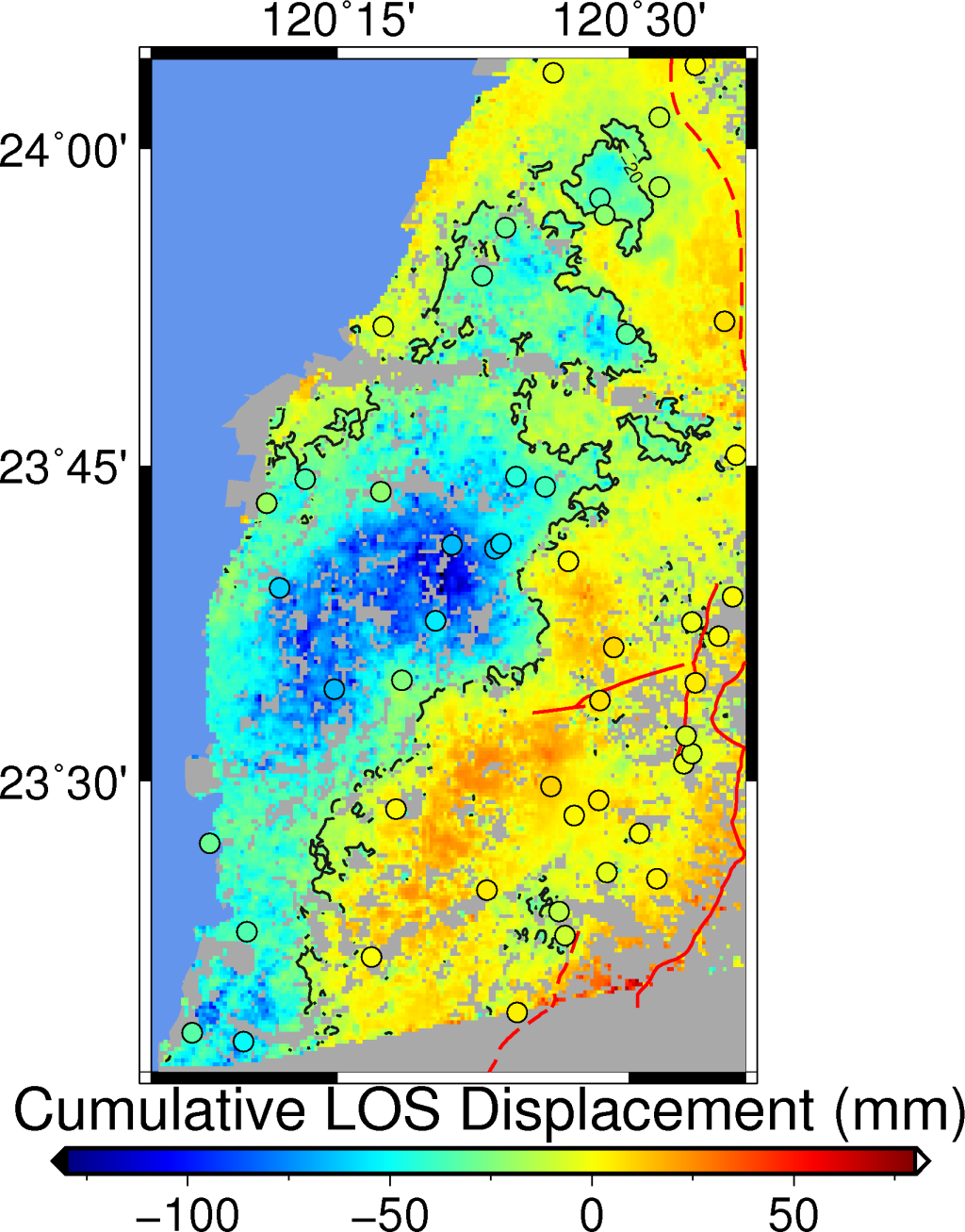
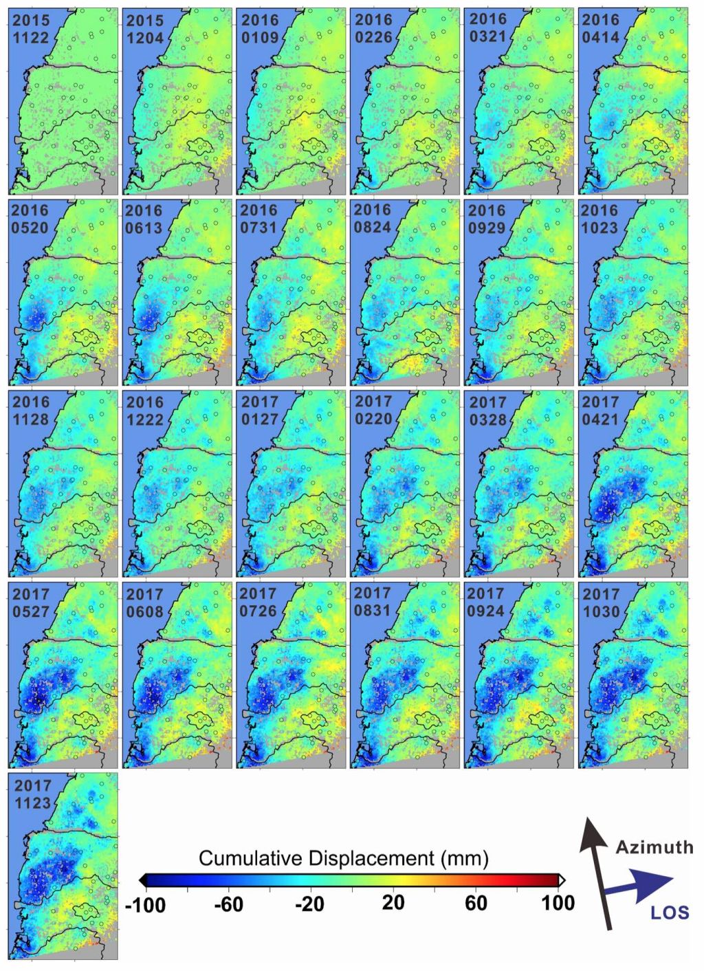
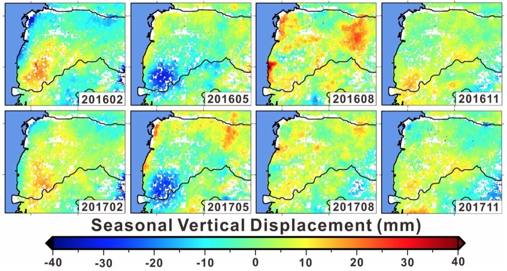
| Summary | By integrating the Global Navigation Satellite System (GNSS) ground observation and multiple satellite remote sensing data, seasonal changes of land use and surface deformation could be observed. The time series with monthly update is used to analyze the causality of land subsidence and tectonic activities. |
||
| Scientific Breakthrough | Synthetic Aperture Radar Interferometry (InSAR) was often used to monitor earthquake events and long-term crustal deformations, due primarily to the restrictions of high-cost and image acquisition. We utilize satellite open data from space organizations to densify the time series of land observation in Taiwan, and hope to provide a thorough dataset for the understanding between land use and surface subsidence. |
||
| Industrial Applicability | Traditional survey of land deformation depends on the leveling and extensive fieldworks, which is expensive and time-consuming. An observation of surface deformation with continuous, long-term, and grid data from satellite remote sensing could improve the efficiency in contrast to the conventional methods. |
||
| Keyword | Satellite remote sensing surface deformation time series analysis land use land subsidence fault activity surveying method synthetic aperture radar optical image land management | ||
- khtseng@csrsr.ncu.edu.tw
other people also saw