


| Technical Name | GIS based Visualization for War Game Platform | ||
|---|---|---|---|
| Project Operator | National ScienceTechnology Center for Disaster Reduction | ||
| Project Host | 陳宏宇 | ||
| Summary | - |
||
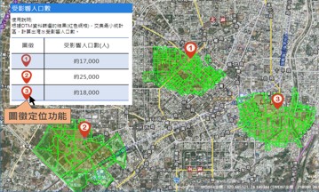
| Scientific Breakthrough | The flood-affected areas can be used as a basis for spatial analysis to find out the near-by shelters, disaster relief resources, affected population, hospitals, elderly care centers,etc. It also uses 3D buildingstreet view to make the response team have an immersive experience, such as viewing the floor of the elderly security center. |
||
| Industrial Applicability | - |
||
| Keyword | Disaster Prevention Response Decision Support Geological Information System War-game Platform | ||
- herothugs@ncdr.nat.gov.tw
other people also saw