


| Technical Name | Real-time identification of crop losses using UAV imagery | ||
|---|---|---|---|
| Project Operator | Nation Chung Hsing University | ||
| Project Host | 楊明德 | ||
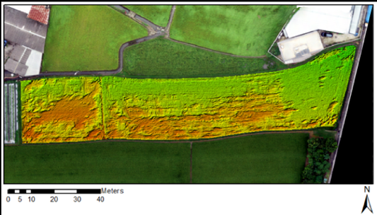
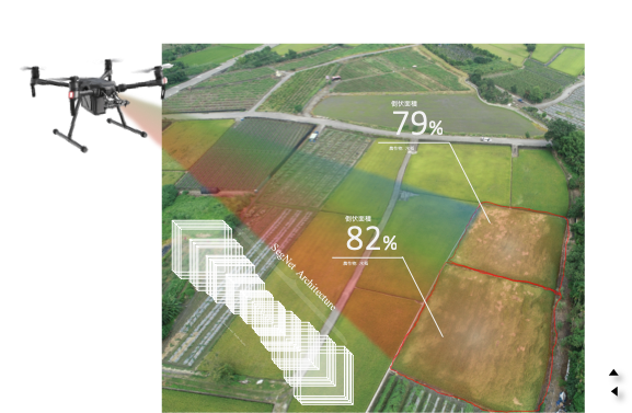
| Summary | This technology integrates 1000+ times of UAV imaging experiences with labeled rice lodging images for training. A rice lodging recognition model using deep learning reaches 90 accuracy. The recognition model can be deployed in a microcomputer mounted on UAVs to implement edge computing. While taking aerial images, the inference can be completedreveal lodging areadamage level in-time. |
||
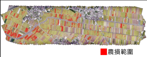
| Scientific Breakthrough | This technology employs image segmentationedge computing to build agricultural disaster image databaseimplement the real-time inference on UAVs. This technology enables surveying personnel to instantly identify crop lossdamage distribution. This technology greatly simplifies the time-consuminglabor-intensive surveyingincreases the efficiency of agriculture loss subsidy. |
||
| Industrial Applicability | This technology accurately quantifies agricultural losssaves manpowertime for loss subsidy. This technology can be beneficial to agricultural practitioners, such as UAV hardwaresoftware developers, agricultural insurance companies,pesticide fertilizer companies. The further research can be extended to large-scale rice field managementagriculture disaster detection. |
||
| Keyword | UAV edge computing rice damage semantic segmentation deep learning image recognition machine learning image segmentation agricultural insurance agricultural management | ||
- daviddrmfsltd@gmail.com
other people also saw