


| Technical Name | 3D GIS Platform | ||
|---|---|---|---|
| Project Operator | National Applied Research Laboratories, NARLabs | ||
| Project Host | 陸璟萍 | ||
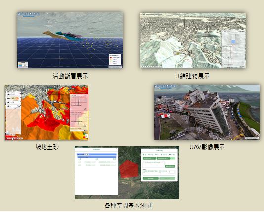
| Summary | Apart from typical 2D GIS platform, the new visual experience can be achieved via the WebGL technology from our intelligent 3D-GIS platform. In this platform, the geospatial Big data can be injected more efficiently ia several aspects e.g. data acquisition accelerationdata structure reconstruction which greatly improve the experience of data visualization. |
||
| Scientific Breakthrough | The geospatial data can be displayed as 3D geospatial model in our 3D-GIS platform in a semi-autoprocessing reconstruction from data re-processingWebGL technology. During the browsing, you can scale up/down, move horizontally/vertically etc. which allows make your own plan for you own purpose. |
||
| Industrial Applicability | "urban plan smart city disaster prevention industry" |
||
| Keyword | |||
- futuretech.most@gmail.com
other people also saw