


| Technical Name | Combining multi-spectral satellite imagery and machine learning methods to establish automatic identification system of landslides and factor analysis of typhoon events | ||
|---|---|---|---|
| Project Operator | National Central University | ||
| Project Host | 林遠見 | ||
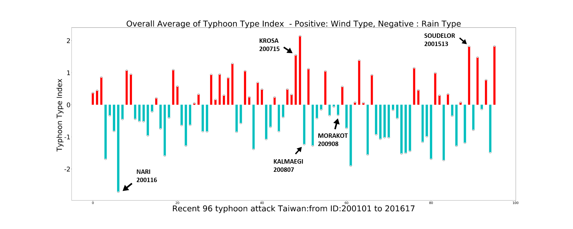
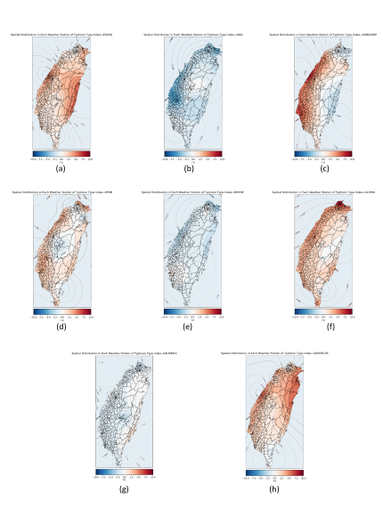
| Summary | The research integrated machine learning, hydrology, and spaceborne optical remote sensing to establish an automatic collapses recognition system. The first part analyzed the features of different typhoons. We studied slope disasters through the created Typhoon Type Index (TTI) to understand the impact of typhoon features spatial distribution in Taiwan on the slope disasters. TTI is the linear regression residual analysis that quantify the typhoon features, which divides typhoons into wind types and rain types, that define the overall damage of a certain area is controlled by strong wind or heavy rain, and then efficiently classify typhoons with similar spatial features into same groups by hierarchical clustering analysis. The second part adopted the Random Forest algorithm to obtain the location, area, shape of each collapse from the multi-band satellite image. Finally, the two parts are integrated to study the influence of typhoon wind and rain features and slope disaster patterns. |
||
| Scientific Breakthrough | This interdisciplinary research integrated plenty of fields, including hydrology and water resources, environmental science, disaster prevention, application of big data analysis, climate change, Geoscience, environmental remote sensing, geographic information system, and risk assessment. Pioneering the technique to discuss the spatial distribution of slope disasters and agricultural damage, corresponding to different types of typhoons, and combined with satellite image analysis to establish a prediction model of the spatial and scale distribution of slope disasters under different typhoon characteristics. |
||
| Industrial Applicability | Through interdisciplinary integration, in addition to establishing the prediction model of typhoon features spatial distribution and slope disasters, and the original Typhoon Type index (TTI), it also extended the analysis of the risk of agricultural loss caused by different types of typhoons. The results and technologies mentioned above allow the government, research agencies, and related industries to refer and apply. Associated applications are slope disaster identification, disaster situation analysis, disaster prevention and response, and disaster risk early warning, etc. |
||
| Keyword | typhoon characteristics landslide factors satellite image recognition machine learning Typhoon Type Index (TTI) agricultural loss image recognition disaster prevention disaster management typhoon-induced disasters | ||
- yclin@ncu.edu.tw
other people also saw